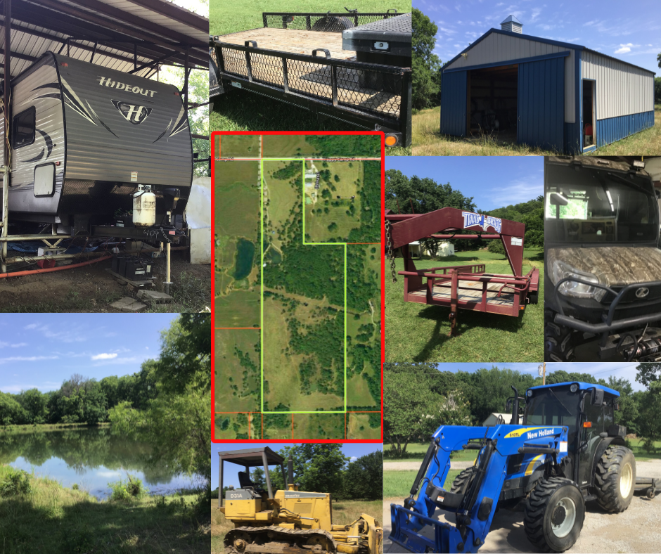
3490 HAPPY CAMP RD, MOUNDS, OK 74421
Personal Representative’s Real Estate & Personal Property Auction
100 AC± in Okmulgee County
PARCEL DESCRIPTION: 100 acres with utilities, 2016 Keystone Travel Trailer (VIN 4YDT38F22G7205409) affixed on covered concrete pad, 34 x 50 Equipment Shelter, 24 x 30 Enclosed Pole Barn, Ponds, Fenced and Gated.
PERSONAL PROPERTY PARTIAL LISTING: New Holland Tractor Model T4030 (s/n #160217000), 2015 Kubota RTV-X1100CRL-A VIN A5KC2GDBVFG020275, Komatsu Bulldozer Model #D314-18, Rotary Mower, Texas Bragg Gooseneck & Utility Trailers, Craftsman Toolboxes, Assorted Tools, Fort Knox Safe (approx. 51” wide, 27” deep, 72 ½” tall), RNH Safe (approx. 30 ½” wide, 72 ½”Tall, 24” deep), 10″ Table Saw & Related.
LEGAL: A tract of land located in the West half of East half of Section 22, T15N, R11E of the IB&M, Okmulgee County, State of Oklahoma, described as follows: Beginning at the NW corner of the West Half of Section 22; Thence N 89° 54’ 04” E along the North line thereof a distance of 70.00 feet to a point; Thence S 00° 08’ 39” E a distance of 415.00 feet to a point; Thence N 89° 54’ 04” E a distance of 95.00 feet to a point; Thence S00° 08’ 39” E a distance of 910.85 feet to a point on the South line of the NW/4 of the NE/4; Thence N 89° 3’ 18” E along said South line a distance of 1155.90 feet to a point, said point also being the NE corner of the SW/4 of the NE/4; Thence S 00° 07’ 25” E along the East line of the West half of Section 22 a distance of 2650.76 feet to a point, said point also being the NE corner of the SW/4 of the SE/4; Thence S 89° 52’ 49” W along the North line thereof a distance of 1319.95 feet to a point, said point also being the NW corner of the SW/4 of the SE/4; Thence N 00° 08’ 39” W a distance of 3976.83 feet to the point of beginning containing 84.47 acres more or less AND A tract of land in the NW/4 of NE/4 of Sec 22, Township 15 N, Range 11E of the Indian Meridian, Okmulgee County, State of Oklahoma, described as commencing at the Northwest Corner of said NW/4 of NE/4; thence N 89°54’04” E along the North line thereof a distance of 70.00 feet to the Point of Beginning; thence S 00°08’39” E a distance of 415.00 feet to a point; thence N 89°54’04” E a distance of 95.00 feet to a point; thence S 00°08’39” E a distance of 910.85 feet to a point on the South line of said NW/4 of NE/4; thence N 89°53’18” E along said South line a distance of 495.45 feet to a point; said point also being the Southeast Corner of the W/2 of said NW/4 of NE/4; thence N 00°08’02” W along the East line thereof a distance of 1325.74 feet to a point on the North line of said NW/4 of NE/4; thence S 89°54’04” W along said North line a distance of 590.89 feet to the point of beginning cont. 15 Acres more/less LESS AND EXCEPT oil, gas, coal and other minerals not owned by grantor.
TERMS: Cash. $50,000 down day of auction as escrow deposit accompanied by proof of funds in the amount of final bid. Balance due within 15 days following confirmation by District Court Creek County. Conveyance by Personal Representative’s Deed. Title Insurance Commitment available.
Auction Date
Starts: July 8, 2023 3:00 pmAuction Type
Live AuctionAuction Description
Personal Representative’s Real Estate & Personal Property Auction
100 AC± in Okmulgee County w/Improvements
New Holland Tractor Model T4030, 2015 Kubota RTV-X1100CRL-A, Komatsu Bulldozer Model #D314-18, Rotary Mower, Texas Bragg Gooseneck & Utility Trailers, 10″ Table Saw, Craftsman Toolboxes, Assorted Tools, 2 Gun Safes & Related
CLICK HERE FOR DETAILS
Contact Information
Auction Location
3490 Happy Camp Road, Mounds, OK 74421
Other Auctions
-

9302 S 43RD W AVE, TULSA 74132
-

INVESTMENT OP – 1119 N Florence Pl, Tulsa OK 74110
-

INVESTMENT OP – 604 N Ross Sapulpa, OK 74066
-

INVESTMENT OP – 1519 E Cobb St, Sapulpa OK 74066
-

ONG SURPLUS, BANKRUPTCY & ESTATE VEHICLES
-

COMING SOON! 30 ACRES± UNIMPROVED LAND – TAHLEQUAH
-
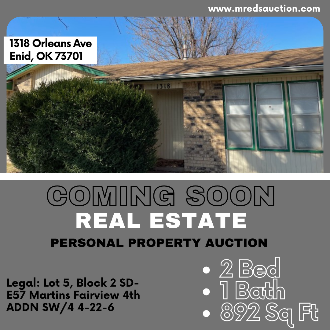
Coming Soon- 1318 Orleans Ave, Enid OK 73701
-
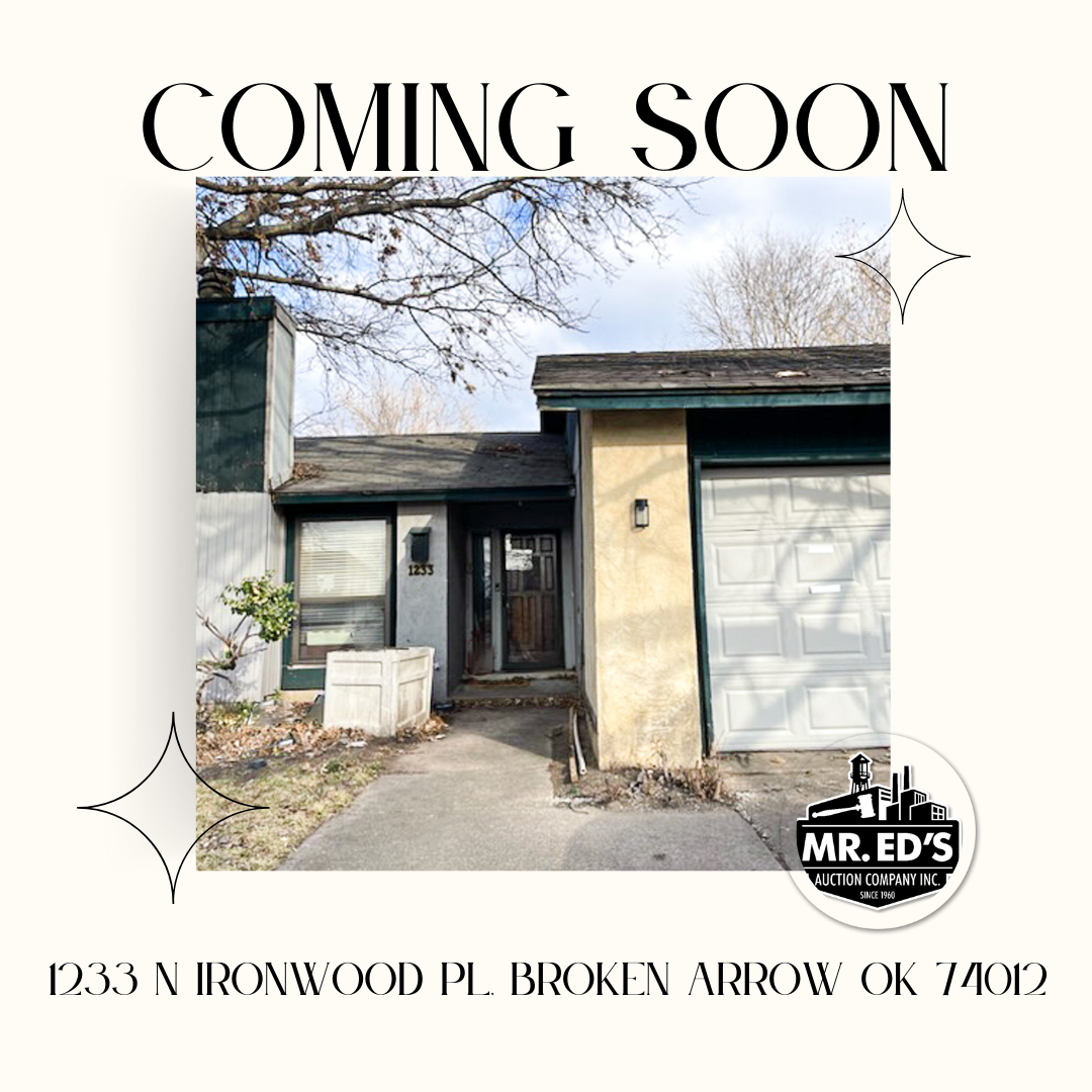
Coming Soon-1233 N Ironwood PL, Broken Arrow OK 74012
